
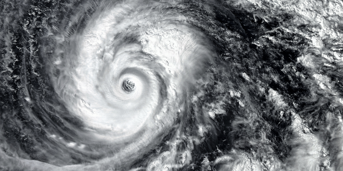
A tropical weather system being monitored over the Atlantic Ocean is drawing attention on Wednesday, August 26, 2026, as forecasters assess whether it could become the next named storm of the 2026 Atlantic hurricane season. If it reaches tropical-storm strength, the system would receive the name Dolly.
The development comes during one of the busiest periods of the Atlantic hurricane season, when tropical activity typically increases significantly. Although the system is not currently a hurricane and there is no indication that it poses an immediate threat to the continental United States, its development is being monitored because tropical weather systems can strengthen or change direction as environmental conditions evolve.
Tropical System Under Observation
The weather disturbance is located in the Atlantic south of the Cabo Verde Islands. Forecasters are evaluating whether the system has the organization and environmental conditions necessary to develop into a tropical cyclone.
A tropical depression is the first formal stage of a tropical cyclone, followed by a tropical storm when maximum sustained winds reach at least 39 miles per hour. A system becomes a hurricane when sustained winds reach 74 miles per hour or higher.
Until a system reaches the required threshold, forecasters do not assign it a storm name. If this Atlantic disturbance strengthens sufficiently, it would become Tropical Storm Dolly under the predetermined storm-naming list.
The potential development of Dolly should not be interpreted as a forecast of a U.S. landfall. Tropical systems can weaken, strengthen, turn away from land or change speed as they travel across the Atlantic. Forecast confidence generally increases as a system becomes better organized and moves into an area where observations and modeling provide more information.
For residents along the U.S. Atlantic and Gulf coasts, the most important distinction is between a tropical system being monitored and an official threat to a particular location. Watches and warnings are issued when specific hazards become sufficiently likely.
The Broader 2026 Hurricane Season
The possible development comes during a hurricane season that federal forecasters have characterized as likely to be less active than average.
Seasonal forecasts provide a broad picture of expected activity across the Atlantic basin. They do not determine exactly where storms will form or whether a particular community will experience a landfall.
A season with fewer named storms can still produce dangerous hurricanes. A single storm that develops under favorable conditions can cause significant coastal flooding, strong winds, heavy rainfall and dangerous surf even when overall seasonal activity is relatively limited.
For that reason, seasonal outlooks should not be viewed as a reason for residents to become complacent. Instead, they provide useful background information about the atmospheric and oceanic conditions that may influence the season as a whole.
Why Ocean and Atmospheric Conditions Matter
Tropical cyclone development depends on several factors, including warm ocean water, moisture, atmospheric stability and wind patterns.
One important factor is vertical wind shear, which refers to changes in wind speed or direction at different levels of the atmosphere. Strong wind shear can disrupt the structure of a developing tropical system by separating thunderstorms from the storm’s center.
El Niño conditions can contribute to increased wind shear over the Atlantic. This can make it more difficult for some tropical disturbances to organize and intensify.
However, no single climate pattern determines the outcome of an individual storm. Local atmospheric conditions, ocean temperatures and the structure of each disturbance can influence whether a system strengthens or weakens.
This is why forecasters continually update tropical outlooks as new observations become available.
What Americans Should Watch
For most people in the United States, the immediate significance of the developing system is the need to follow reliable weather information rather than speculation.
Residents in coastal areas should pay particular attention to official forecasts if the system’s projected path changes. Even storms that do not make a direct landfall can produce dangerous rip currents, coastal flooding and heavy rainfall.
People living farther inland should also remember that hurricane impacts are not limited to coastal communities. Strong storms can produce flooding, tornadoes, power outages and damaging winds well away from the point where a storm reaches land.
The Atlantic hurricane season officially continues through November 30, meaning additional tropical systems may develop during the coming months.
Key Takeaways
The potential development of Tropical Storm Dolly is a reminder that tropical activity can emerge quickly during the peak portion of hurricane season. At this stage, the system’s possible development does not by itself indicate that a hurricane is headed toward the United States.
The most useful approach is to distinguish between an area of disturbed weather, an organized tropical depression, a named tropical storm and a hurricane. Each stage carries different implications, and official forecasts become increasingly important as a system develops.
For Americans, particularly those living in hurricane-prone regions, the broader lesson is straightforward: a below-average seasonal forecast does not eliminate the possibility of a serious storm. Staying informed, understanding official warnings and maintaining basic preparedness remain important throughout the hurricane season.